
 EN
 Crnogorski
 Русский
Leica BLK360 G2 accuracy: a façade survey checked against GNSS
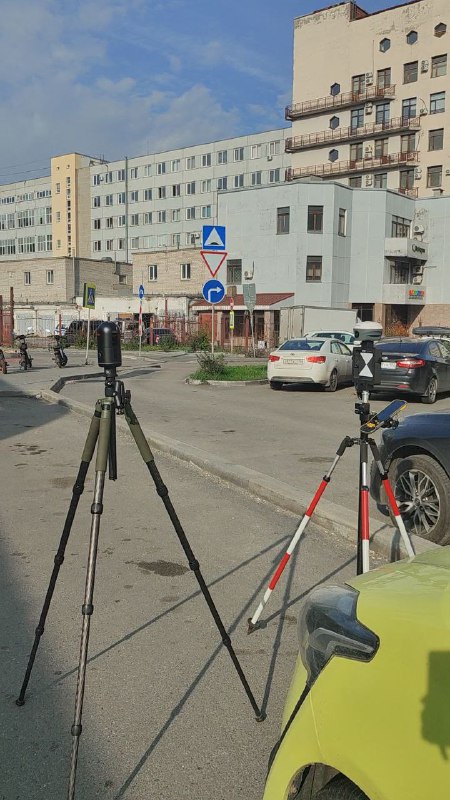
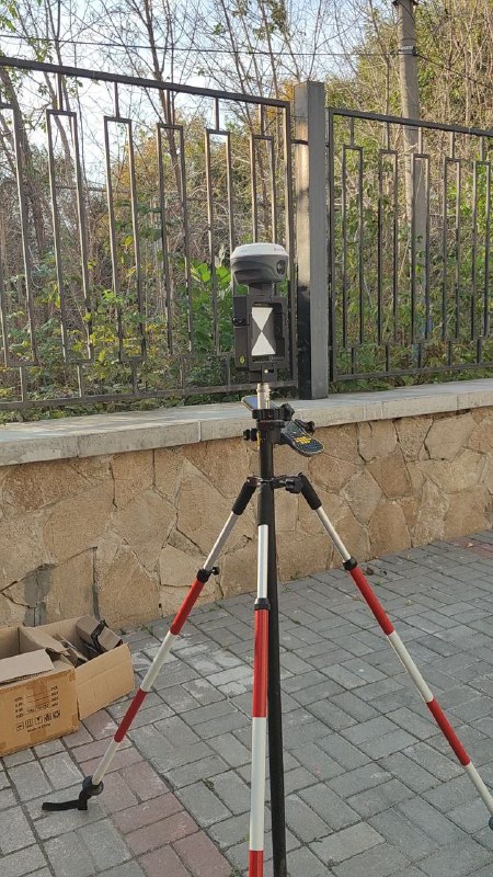
After reviewing the Leica BLK360 G2 and comparing it with the G1, I wanted to look at accuracy on a real façade survey. I used a survey target with a mounting point for a GNSS receiver to compare the registered scan network with external measurements.
The setup: scanner, target and 14 points
The equipment was a Leica BLK360 G2 and a Meridian M20L receiver, working in RTK mode from an EFT base station. The target and receiver were mounted on a tripod. I measured 14 points in a challenging urban environment, keeping points independent for checking. The aim was to compare processing with and without control data.
What the registration report shows
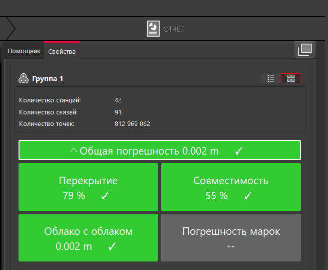
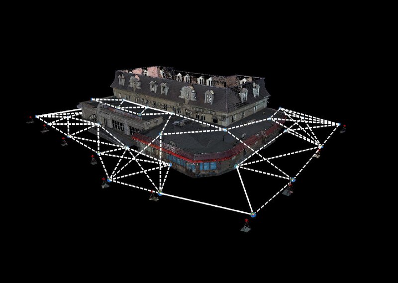
The final bundle contains 42 setups and 91 links. Cyclone Register 360 reports an overall error of 0.002 m and the same cloud-to-cloud error, with 79% overlap. That was a good registration result for this façade dataset. The 2 mm value describes registration consistency; it does not establish 2 mm absolute accuracy for every façade point.
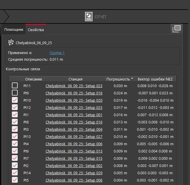
The control-links table reports a mean error of 0.011 m. Checked rows range from 0.004 to 0.019 m. Two further rows, at 0.024 and 0.030 m, are unchecked. The original post's shorthand — from 4 mm, more often around 1 cm — therefore does not describe the full table range. The post does not document why those two rows were unchecked.
The practical lesson for façade surveys
The BLK360 G2 produced a well-aligned façade cloud in this test. External observations added a useful check beyond the registration figure. GNSS observations in built-up streets carry their own uncertainty, so the residual cannot be attributed entirely to the scanner. Equally, a tight registration alone does not demonstrate centimetre-level georeferencing.
This was an encouraging field result for the compact scanner in my façade-survey workflow. It remains a project-specific check, rather than a metrological certification of the instrument. PPK was not part of this experiment; I left it for a separate comparison.
More field experience with the BLK360 G2
First impressions and kit — part 1
BLK360 G2 versus G1 — part 2
For façade geometry and existing-building survey data in Montenegro, see building surveys for renovation.